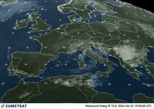
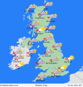
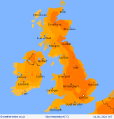
UK Forecast- June 23, 2024
Very warm
Risk showers north & west
 Monday
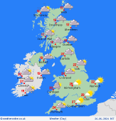
A fine and warm day overall. Early mist patches soon dispersing to leave plenty of sunshine, some fair-weather cloud building. Small chance of an isolated shower. Locally mistier near to some southwestern coasts, but sunny near many coasts afternoon onward. Risk some rain far west of Scotland and Ireland. Light to moderate southerly winds, coastal sea breezes. Highs 20 to 26C, warmest east and south.
 Monday night
Dry for most of Britain overnight, variable cloud and clear spells for England, Wales and eastern Scotland. More cloud toward the west of Scotland and for Ireland. Along the Atlantic coastlines some patchy rain or drizzle associated with a slow-moving front to the west, southerly breezes here too. Mild temperatures, lows 11 to 15C, warmer in towns and cities in central and southern England.
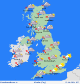 Tuesday
Many places likely to stay dry and feeling very warm. Sunshine best in the east and south, hazier in the west. Some rain for the west of Scotland and over Ireland. Local bursts of rain may form over eastern Scotland and northern England by late afternoon, possibly thundery. Southerly breezes, strongest in the west. Highs 22 to 28C, warmest east and central England.
 Wednesday
Many places dry with warm sunshine and variable high cloud. Some patchy rain toward the north for a time. Local afternoon showers may form, chance of an isolated thunderstorm forming later, mainly western areas. Light and variable winds, sea breezes. Highs 21 to 28C, warmest toward central and southeastern England.
|